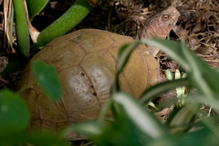
We didn't get much advice, but they suggested the Font's Point jeep road. Sadly, that was everyone else's thought, too. (More on this point later.) But! On the hike from the parking area out to the point/overlook, I spied a slower-moving lizard. (I think he's a Zebratail Lizard, but I need an actual reptile field guide as opposed to a "Deserts" field guide.)
On the hike to the point I met a young girl (sporting the same camera I had, tho' a different lens) and her grandfather (sporting *much* more camera and lens than I had). We had a nice chat. It turns out that he's a travel writer and photographer (which pays for all that camera) as well as a certified Search and Rescue Master for California. An interesting guy with some interesting stories.
Speaking of the point, Font's Point looks out over the Badlands. They're very much like THE Badlands in Dakota, but covering many fewer square miles. MANY fewer. (I've been to the Badlands.) I took a bunch of photos, but I need to decide which "stitching" software I want to use. (I'm new to "stitching." Any tips? I'm on a Mac.) But here's a sample.
I promised "more" on the point that everyone else went out to Font's Point. I figured out that one of the popular (and very inexpensive) ABDSP maps/field guide has the Font's Point jeep road and a number of other features on it, but not ALL the jeep roads and features that are spelled out on the expensive map. The hike up Lizard Wash was utterly unpopulated for us until we were almost back to the highway. And the only folks then were a pair of teens who had parked their Scion at the highway and were on foot.
So, if you're going and want to avoid the crowds, get the cheap map AND the expensive map. The field guide with the cheap map is good and it will let you filter out the popular spots from the much cooler, less traveled spots. :-)


Photoshop element's merge thingie is pretty amazing in the latest version.
ReplyDeleteThanks! I'll give it a go.
ReplyDelete