


As I mentioned in the last post, it started raining Saturday evening and continued to rain (a fairly cold rain with a little wind) all day Sunday during the trip, so I didn't take very many photos. But the rain didn't ruin the field trip so much as it turned it into more of an adventure as the day went on.
One of the requirements of the class was that you had to be in a 4WD vehicle, so we got one. The class consisted of about a dozen 4WD vehicles following one another up the Fish Creek Wash, stopping occasionally to get a little piece of the talk (while getting a little more wet) or to take a short hike to see something neat (in the form of an anti-cline or fossil footprints or fault offsets or layers of rock and soil).
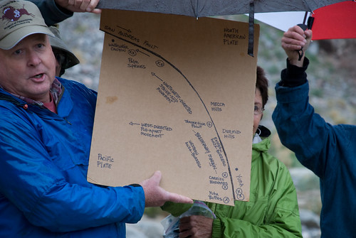
Our class guide, instructor, and author, Paul Remeika, talked (under an umbrella to protect the props) about the fault system in Southern California, how the San Andreas slides along a curve, and how land forms at Whitewater Canyon (on one side of the fault) match up with land forms near Yuma (on the other side of the fault).
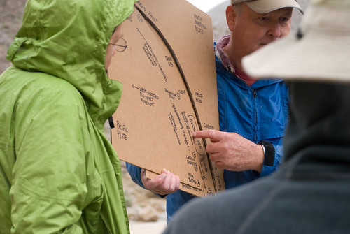
He also explained that, in part because of the curving fault, the land opened into a gap where the Salton Sea currently sits.
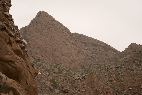
And, of course, we got to look at the layers that have been laid down and washed away over the eons.
And, of course, we got to look at the layers that have been laid down and washed away over the eons.
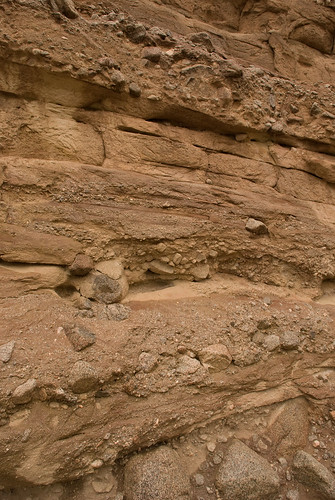
And we got to see the tilted layers that have been jacked up by tectonic movements.
But the real adventure started on the return trip. After all, we had spent over half a day driving up a "wash" in the rain. And what happens to a "wash" when it rains? Well, it fills up with water. Happily, we were being led by a guy who had spent the last 30 years of his life working as a ranger in this area. So, we followed his lead back down the wash that was running with water -- or, more accurately, mud -- till we got back to the Fish Creek Primitive Campground.
Happily, the campground was a good 30 feet above the bottom of the wash, so the camp wasn't going to wash away. The rain finally stopped late in the evening and had mostly soaked into the sand by the next morning. Things were still a little muddy and there were still a few areas of standing water, but there was no more flowing water... in Fish Creek Wash.
There was still plenty of running water in other areas of the park. And all that running water exposed a LOT of really big rocks on a lot of the "Jeep roads" all over the park, making passage by vehicles with anything less than maximal clearance 4WD vehicles rather adventurous. (We only had the rental 4WD for a week.)
I think I commented on the photos already, but I really do like that sediment layers photo! Very cool.
ReplyDelete